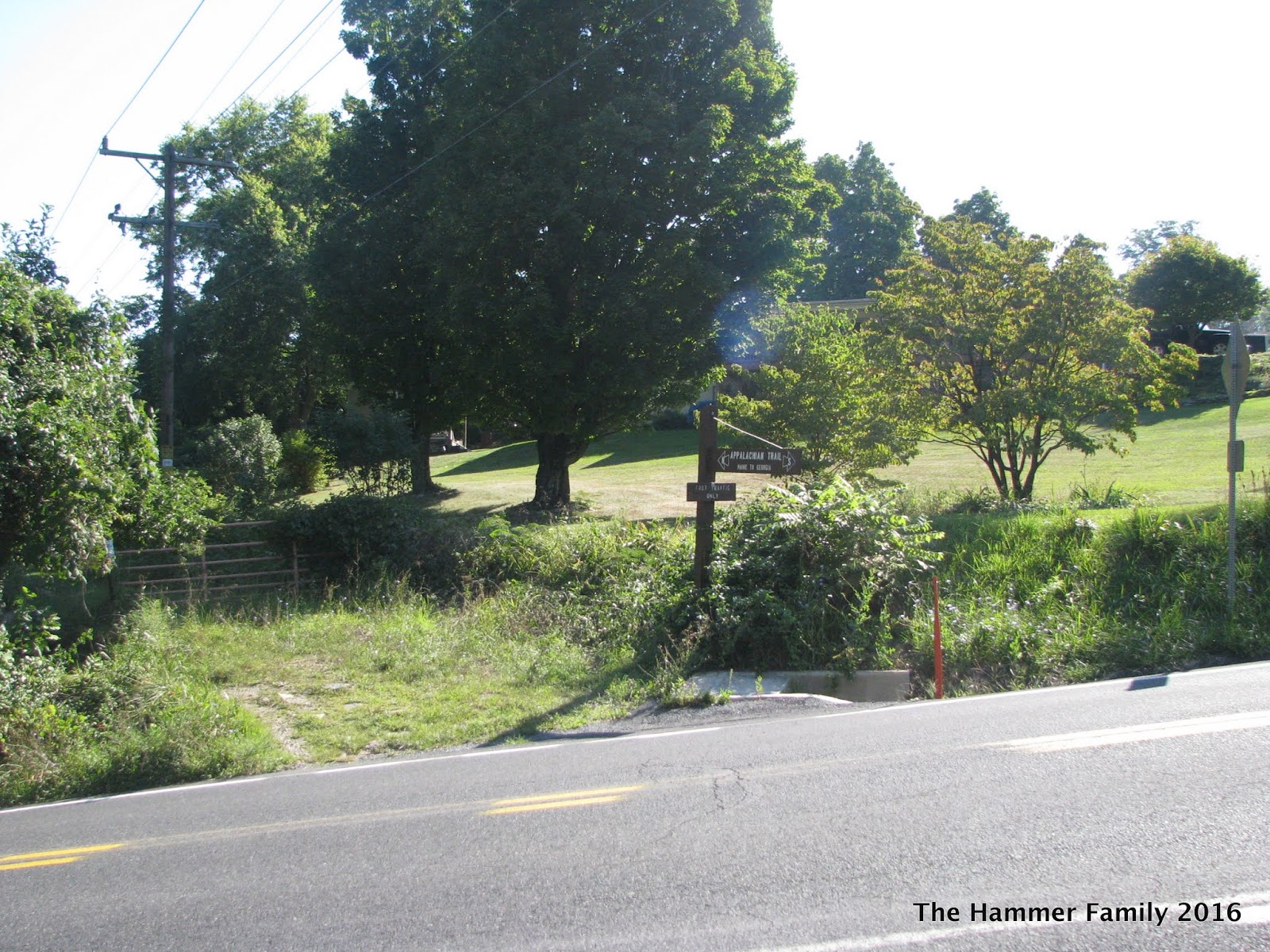
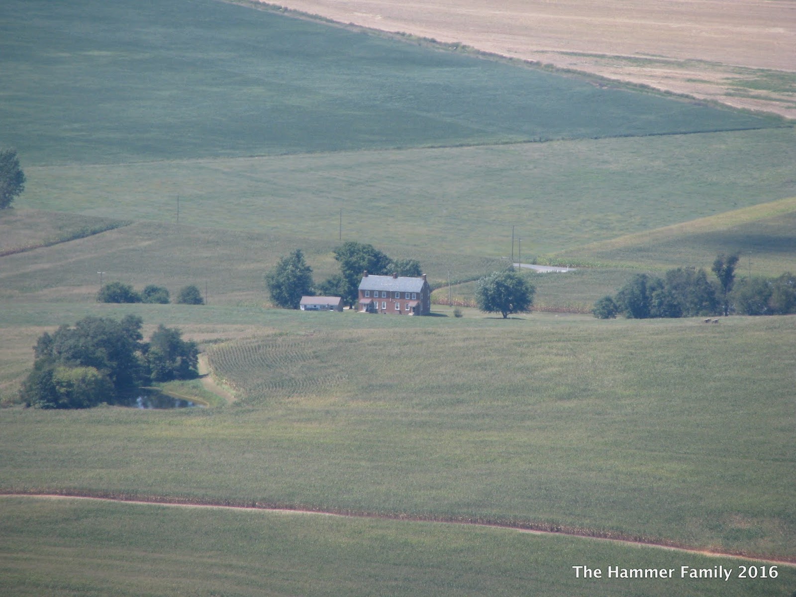
View from High Rock on Quirauk Mountain

View from High Rock on Quirauk Mountain

Pages

Sunday, August 27, 2017

Weverton Cliff Hike


As I've said before, the Harpers Ferry area has become one of my favorite places to visit since I've moved to the East Coast. The view of Harpers Ferry and the confluence of the Potomac and Shenandoah Rivers from Maryland Heights is a wonder that everyone should see at least once. As the Potomac continues to meander its way through the gap it has carved in the Blue Ridge Mountains, it flows past another excellent vantage point: Weverton Cliff.


Weverton Cliff is located at the southern end of South Mountain in Maryland just off the Appalachian Trail. The trailhead is located at the end of Weverton Cliff road, a few yards from the parking lot- just a set of rock steps that disappear into the woods. The trail is very rocky, and winds up the hill via a series of switchbacks. In fact, I lost count of how many times the trail turned back on itself, but it makes the climb *much* easier. It's definitely a good workout, but not nearly as strenuous as the Maryland Heights hike, which is pretty much a straight climb.

The trailhead:

 One of the many switchbacks

At times the path is quite narrow. This is also one of the few sections of trail that's generally free of large rocks.


Big pile of rocks.

Very rocky trail, wear good boots with ankle protection, and use those trekking poles for balance and support!


When you reach the top of the hill, you'll come across a T-intersection with a sign post directing you toward the cliff or north on the AT. Unfortunately, the sign board pointing to Weverton Cliff was missing, but, as usual on the AT, follow a light blue blaze for side trails.


The trail to the cliff overlook takes you down the hill a bit.

Once at the overlook, you'll have to do some rock scrambling to get the best vantage point to take some really great pics. I only had my phone camera, but it worked pretty well...


You can see the bridge where US340 crosses the Potomac into Virginia, but without binoculars I could not discern Harpers Ferry at all. The ridge on the left is Loudon Heights, on the right is Maryland Heights and Elk Ridge. The Stone Fort, on Elk Ridge, might be more visible once the leaves have fallen.


Some kayakers were enjoying the beautiful weather on the river.


Back to the sign, headed down the hill...


After visiting the cliff, I traveled north on the AT for a short distance before turning around and heading back to the car. The AT continues a gradual climb heading north along the ridge. I was initially going to aim for the Ed Garvey Shelter as a turn-around point, but I got a late start and decided to head home.

Notes:

As usual, wear a good pair of hiking boots. The trail is very rocky, and there are plenty of opportunities to twist an ankle. Trekking poles are highly suggested for balance. The trail is dog friendly, and I saw lots of people with their dogs while on my hike. As always, keep your dog on a leash and clean up any messes. I would not recommend this hike for small dogs, or dogs that can overheat easily.


How to get there:

Set your preferred GPS navigation system to Weverton Cliffs Parking Lot.  From Eastern Maryland: Get on Interstate 70W, take the exit to US340 south, same as if you were going to Harpers Ferry. Look for signs for MD 67 towards Boonsboro. Take the MD 67 exit and keep right. Weverton Cliff road is the first right after the exit. The parking lot is on the right a few hundred yards down. 

Note: parking is extremely limited, only about 22 spaces, although there were a few cars parked along the side of Weverton Cliff road when I returned from my hike. Highly recommend that you get an early start on a weekend day, but I imagine that parking on weekdays is likely much more open. An extreme alternative is to park at the Harpers Ferry parking lot, take the bus into downtown, and hike the 1.5 miles along the AT (and C&O Canal) to get to the trail head for Weverton Cliff.

Another option, if you've got a second hiker and car, is to visit the cliffs via a one-way 6+ mile shuttle hike from Gathland State Park south to Weverton Cliff. Park a car at the Weverton Cliff lot, and then you and your hiking partner can ride up to Gathland SP to start. At the end of the hike, shuttle the other driver to their car back at Gathland SP.

Sunday, September 18, 2016

Cunningham Falls State Park - Manor Area, Bob's Hill, and Cat Rock


I've visited and posted about Cunningham Falls SP before, but I hadn't hiked in this section of the park.

Much less visited than the falls and lake area, the Manor area of Cunningham Falls SP is a much more suitable destination if you're looking for some solitude, but like any Maryland State Park, you'll probably still encounter fellow hikers on weekends.

On a warm summer day I took on the challenge of climbing Bob's Hill.  The trail up the mountain runs concurrent with the Catoctin Trail, which begins in Gambrill State Park, a park which will be featured in another blog post.

The trail head is directly across from the Manor area visitor center. There's another trail head closer toward the park entrance, but either will work.

I first wanted to walk down to Little Hunting Creek, a lovely mountain stream. The path to the creek is also part of the Catoctin Trail, which crosses the creek and continues south from here. The trail goes up a bit before reaching an intersection to take you either down to the creek, or up the mountain.


To get to the creek, take the Blue Trail (aka the Catoctin Trail) south.


Little Hunting Creek


After taking in the quiet sounds of the creek, turn around and head back up to the trail intersection.

Back to the Catoctin (blue) Trail North.

It's a pretty good climb, so I'd definitely rate this a strenuous hike. The hike up Bob's Hill presents you with a 1,000 foot elevation gain in about 1.5 miles. Take your time, and plenty of water breaks!


After a nice climb, you'll reach the summit of Bob's Hill which is 1,765 feet, according to the marker. You'll also notice two paths on the left and right, toward the overlooks. Take the one on your left first, it's the better of the two.

Bob's Hill Overlook, looking south along Catoctin Mountain.
 The overlook is a rocky outcropping somewhat similar to Chimney Rock or Annapolis Rocks.


 Yes, that's Sugarloaf in the distance!

Looks like someone had a little fire up here. Shame!
*please folks, don't start fires in unauthorized places.


Once you head back toward the main trail, you can check out the North Overlook. It's not nearly as open and grandiose as the South Overlook, but you can get a good look at some rocks.


Ok, back to the trail.

Continuing down the Catoctin Trail, it's about another 1.2 miles to the Cat Rock trail intersection. This section is relatively easy, so enjoy it. The trail to Cat Rock will be on your right, and there will be a sign. The trail to Cat Rock is blazed yellow and gradually descends from 1,700 feet to about 1,500 feet over about a mile and a half. Note that you'll split off from the Catoctin Trail at this point, which continues over the mountain and down toward the William Houck area of Cunningham Falls State Park. The intersection is clearly marked, so there shouldn't be any confusion.

Cat Rock

The light gray rocks at the summit of Cat Rock and nearby Bobs Hill are quartzite – metamorphosed sandstone – originally deposited about 500 million years ago during the Cambrian Period. During much of that time, the seas teamed with life, but the land was mostly barren with only a few isolated microbial life forms existing. The quartzite rocks belong to the Weverton Formation, the primary ridge-forming unit of Catoctin Mountain and, to the west, South Mountain, the two main ridges in the Blue Ridge of Maryland. -source: Maryland DNR
Looking back at the map, you'll see now that you've taken the long way to get to Cat Rock, but I feel that it's worth the extra effort.

Cat Rock is a huge pile of rocks, and if you're interested in getting a better view, you'll have to do some rock scrambling to climb to the top. There are large crevices and cracks, so please take your time and be sure of your footing.


...and of course, the panorama view from (almost) the top:


Getting there:

Set your navigation app to the Manor Visitor Center
-from the Baltimore area: Head west on Interstate 70, and then take exit 53B in Frederick for US15 North. Follow signs for Cunningham Falls SP Manor Area, which will be on the left as you're heading north on US15.

Daily use fee is $3, on the honor system most days.

Other nearby places of interest:
Catoctin Iron Furnace
Catoctin Wildlife Preserve and Zoo

Happy Hiking!

Wednesday, September 7, 2016

Pen Mar Park to High Rock

A tough hike with a worthy payoff...

So I've been trying to chip away at sections of the Appalachian Trail in Maryland, and since I've done a couple of the middle sections, including the hike to Annapolis Rocks, and a hike from the Washington Monument to the I-70 bridge, I thought I'd do a border crossing this time. There was also the challenge of climbing Quirauk Mountain, the highest point on the Appalachian Trail in Maryland (as well as the highest point on South Mountain).

The northern terminus of the AT in Maryland is at Pen Mar, in the northeast corner of Washington County, MD. The town of Pen Mar sits just south of the Mason-Dixon line.

So, to get up on top of South Mountain, you first have to travel to Pen Mar Park.


In the late 19th and early 20th centuries, Pen Mar Park was quite the destination for tourists. The site hosted an amusement park and resort, served by the Western Maryland Railroad. People rode the train from Baltimore to enjoy all that Pen Mar had to offer. Pen Mar once hosted huge crowds: up to 20,000 people on a summer weekend!

The park eventually began to lose money, and was torn down in 1943, and the city that profited from the amusements became a quiet town on the Mason-Dixon line. The Pen Mar County Park as it is today (more or less) was established in 1977.


I arrived at Pen Mar and parked in the gravel lot across from the Park.  The sign denoting the Appalachian Trail is near the overlook, visible from the entrance.

Clearly if you're going to drive all this way, you should head north into Pennsylvania, just to cross the border. You can always tell people you walked from Maryland to Pennsylvania and back!

The path north takes you about 100 yards to a T-intersection of sorts. Turn left and be careful crossing the train tracks. There will be a sign showing where the AT is.


Just a few steps into the wooded area, and you're at the Mason-Dixon Line.


I have to admit that this was another 'feature' of this hike that drew me. I'm very interested in history, and this boundary between the "North" and "South" is definitely an important historical marker. The line has its origins in a boundary dispute between the colonies of the Penn family and the Calvert family...which of course are now Pennsylvania and Maryland.


Who knew that the Mason-Dixon Line had a post box?
There's a guest book inside the box, but I didn't leave my name.

From here, the AT turns to the right, and goes by a sign and under a power line cut before a road crossing.


I didn't cross the road here, so this is as far as I went into PA. I turned around and headed back toward Pen Mar Park.

The hike from Pen Mar Park to High Rock on South Mountain is approximately 3.1 miles (one way) and for the most part, is relatively easy. However, for the last 0.8 mile, there's an approximately 500-foot ascent which will test your legs and endurance.

Unfortunately for you, I didn't take any pictures while on the trail itself, because I was busy navigating rock fields and then climbing the mountain. Fortunately for you, I did pull my camera out once I reached the High Rock Overlook. The last mile might be really difficult, but the view is definitely worth it.


View from High Rock on Quirauk Mtn.


A couple of notes: the climb up to High Rock is very rocky and steep, so make sure you have good footing and go slowly. The platform at High Rock used to be a launch point for those brave enough to take to the sky in a hang glider, but I've found out that hang gliding without a permit from High Rock is now illegal. I think I'll keep my feet firmly planted on the ground. Otherwise the platform is tagged with all kinds of graffiti, and I've heard it gets slippery when wet, so be careful!

Bonus: Here'a video of High Rock from a drone!