I've visited and posted about Cunningham Falls SP before, but I hadn't hiked in this section of the park.
Much less visited than the falls and lake area, the Manor area of Cunningham Falls SP is a much more suitable destination if you're looking for some solitude, but like any Maryland State Park, you'll probably still encounter fellow hikers on weekends.
On a warm summer day I took on the challenge of climbing Bob's Hill. The trail up the mountain runs concurrent with the Catoctin Trail, which begins in Gambrill State Park, a park which will be featured in another blog post.
The trail head is directly across from the Manor area visitor center. There's another trail head closer toward the park entrance, but either will work.
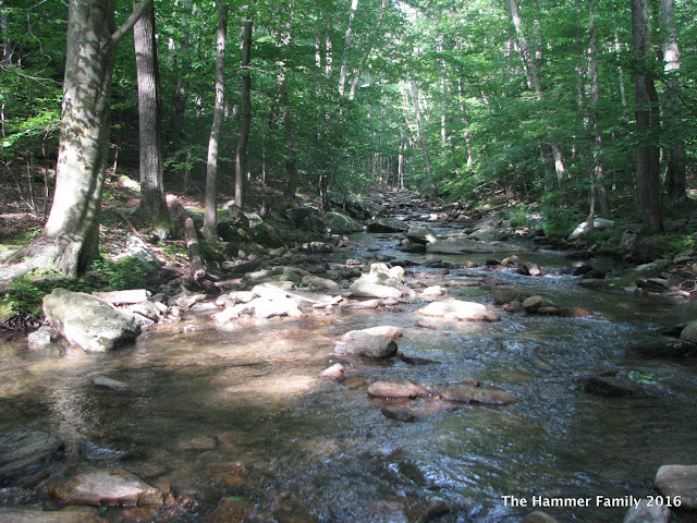
I first wanted to walk down to Little Hunting Creek, a lovely mountain stream. The path to the creek is also part of the Catoctin Trail, which crosses the creek and continues south from here. The trail goes up a bit before reaching an intersection to take you either down to the creek, or up the mountain.
To get to the creek, take the Blue Trail (aka the Catoctin Trail) south.
Little Hunting Creek
After taking in the quiet sounds of the creek, turn around and head back up to the trail intersection.
Back to the Catoctin (blue) Trail North.
It's a pretty good climb, so I'd definitely rate this a strenuous hike. The hike up Bob's Hill presents you with a 1,000 foot elevation gain in about 1.5 miles. Take your time, and plenty of water breaks!
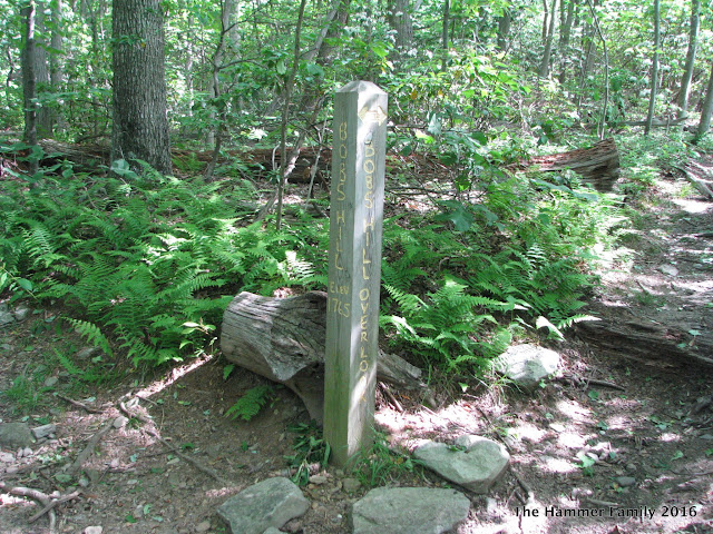
After a nice climb, you'll reach the summit of Bob's Hill which is 1,765 feet, according to the marker. You'll also notice two paths on the left and right, toward the overlooks. Take the one on your left first, it's the better of the two.
Bob's Hill Overlook, looking south along Catoctin Mountain.
The overlook is a rocky outcropping somewhat similar to Chimney Rock or Annapolis Rocks.
Looks like someone had a little fire up here. Shame!
*please folks, don't start fires in unauthorized places.
Once you head back toward the main trail, you can check out the North Overlook. It's not nearly as open and grandiose as the South Overlook, but you can get a good look at some rocks.
Ok, back to the trail.
Continuing down the Catoctin Trail, it's about another 1.2 miles to the Cat Rock trail intersection. This section is relatively easy, so enjoy it. The trail to Cat Rock will be on your right, and there will be a sign. The trail to Cat Rock is blazed yellow and gradually descends from 1,700 feet to about 1,500 feet over about a mile and a half. Note that you'll split off from the Catoctin Trail at this point, which continues over the mountain and down toward the William Houck area of Cunningham Falls State Park. The intersection is clearly marked, so there shouldn't be any confusion.
Cat Rock
The light gray rocks at the summit of Cat Rock and nearby Bobs Hill are quartzite – metamorphosed sandstone – originally deposited about 500 million years ago during the Cambrian Period. During much of that time, the seas teamed with life, but the land was mostly barren with only a few isolated microbial life forms existing. The quartzite rocks belong to the Weverton Formation, the primary ridge-forming unit of Catoctin Mountain and, to the west, South Mountain, the two main ridges in the Blue Ridge of Maryland. -source: Maryland DNRLooking back at the map, you'll see now that you've taken the long way to get to Cat Rock, but I feel that it's worth the extra effort.
Cat Rock is a huge pile of rocks, and if you're interested in getting a better view, you'll have to do some rock scrambling to climb to the top. There are large crevices and cracks, so please take your time and be sure of your footing.
...and of course, the panorama view from (almost) the top:
Getting there:
Set your navigation app to the Manor Visitor Center-from the Baltimore area: Head west on Interstate 70, and then take exit 53B in Frederick for US15 North. Follow signs for Cunningham Falls SP Manor Area, which will be on the left as you're heading north on US15.
Daily use fee is $3, on the honor system most days.
Other nearby places of interest:
Catoctin Iron Furnace
Catoctin Wildlife Preserve and Zoo
Happy Hiking!


No comments:
Post a Comment
Hello! Please leave your comments!
(All comments will be moderated, so if yours doesn't show up right away, please be patient.)