View from High Rock on Quirauk Mountain

View from High Rock on Quirauk Mountain

Pages

Showing posts with label Hiking. Show all posts

Sunday, March 25, 2018

Hiking into the Keystone State - Part 2: PA State Route 16 to Old Forge Picnic Area, Michaux State Forest


The second part of this hike was twice as long and I'd say twice as nice. This hike took me into the southern end of Pennsylvania's Michaux State Forest, up to a park/picnic area called Old Forge.

After parking at the PA SR 16 lot and crossing the highway, you re-enter the woods and cross the southern boundary of Michaux State Forest.  The forest covers over 85,000 acres in Cumberland, Adams, and Franklin Counties. (Follow the link to learn more!)

Going north!

Into the forest...


The trail runs fairly straight, ascending slightly before reaching Mentzer Gap Road. The trail crosses the road and bears to the left before turning back into the wooded area.


A little more climbing, and another road crossing: this time Rattlesnake Run Road, and finally you're into the main portion of the hike. The trail bears generally west until you crest the hill and come down the other side, and then turns north and descends slightly through a tunnel of green. This eventually leads you to a small clearing, and a sign for a spring. The spring was flowing fairly well, but was full of leaves. 

Spring source, leaves floating on the water

The spring is 30 yards beyond the sign


From the spring, the trail turns again, continuing into the forest. The trail here is generally flat, with a few gradual ups and downs.

After about 2 miles, you come across the Deer Lick (Run) Shelters. There are two Adirondack-style shelters here, the openings face away from each other. There are also two tent pads behind the shelters. I didn't see any other tent pads. There is a spring up the hill in front of the shelters, which I believe forms Deer Lick Run, which you cross as you continue north on the trail.

Shelters from the trail

Shelters from the "Spring" sign

Shelter closeup

Deer Lick Run


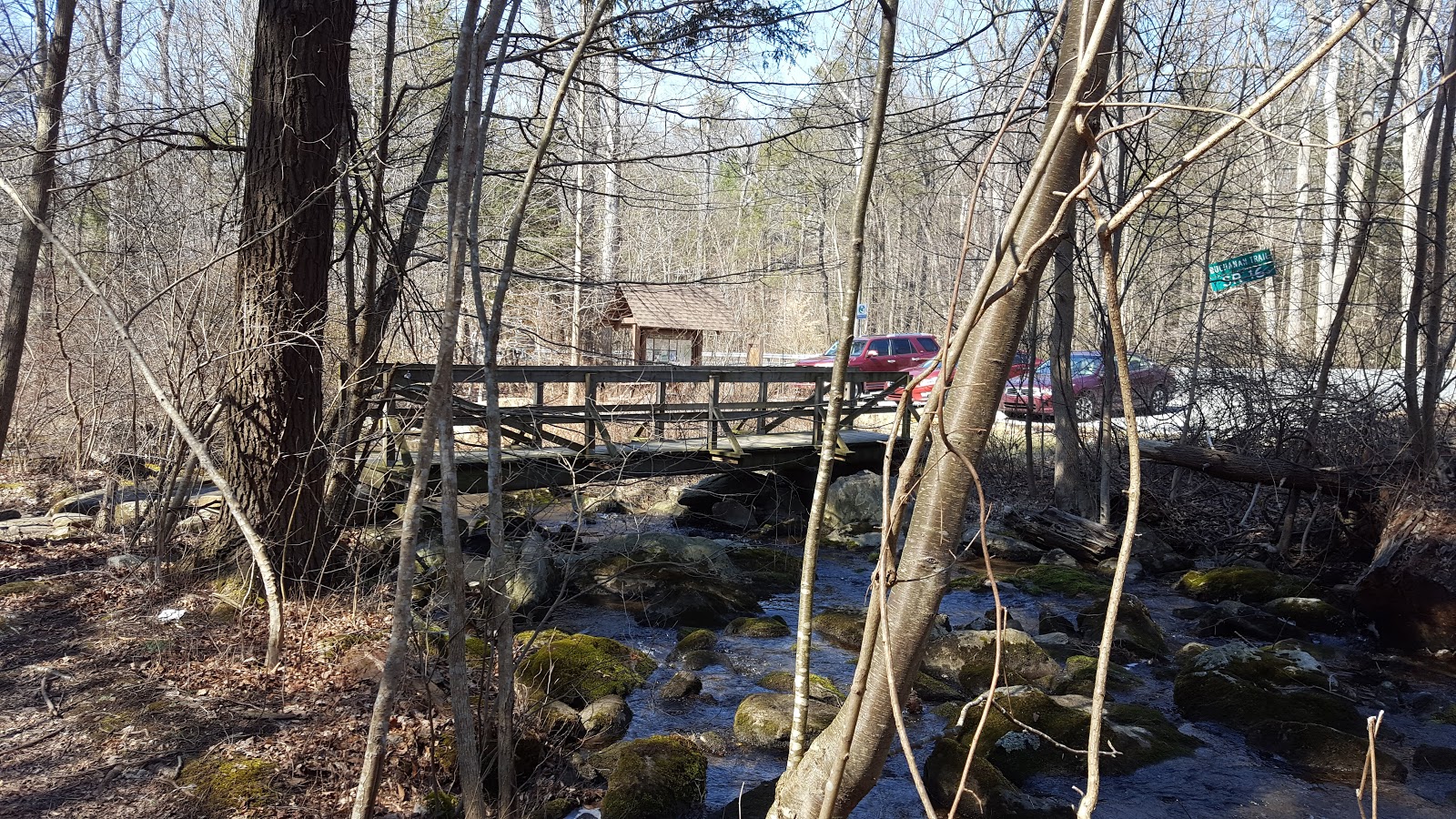
Here the trail will gently climb, and you'll come across first a gas line cut, and then what is probably a fire road. Not long after this, the trail begins to descend into the valley toward Old Forge.  It gets kind of steep at times, so step carefully. The trail eventually flattens out before another more gradual descent just before you reach Old Forge. You'll hear the sound of running water before you see the creek and footbridges.  You'll cross two footbridges over two branches of Antietam Creek, which runs out of the Waynesboro Dam.

Crossing the gas line cut

Crossing the gravel road

Coming down from the ridge

Bridge over Antietam Creek
Continuing further along the trail, you'll cross another (probably gas line) cut in the trees, and then another footbridge, taking you toward the main part of the Old Forge picnic area. There's a small building which has a spigot/water tap. The sign said fresh water year round...but I didn't try it.

The Old Forge Picnic area has about 10-12 parking spaces, a couple of picnic shelters, and some vaguely historic-looking buildings. I'm sure there's more to the park, but I didn't do much exploring.

Water tap here

Coming into the main area of the park

Old church


Parking
A few more pics of Antietam Creek for your enjoyment...


As stated before, I did this hike and the previous one as out-and-backs. If you have a hiking partner, you could easily do both (Pen Mar to Old Forge) as a one-way, approximately 6.8-mile shuttle hike, leaving a car at Old Forge, and then driving to Pen Mar to begin the hike.

For my next hike, I'll probably start at Old Forge and keep exploring into Pennsylvania. Definitely need to knock out a section or two of Maryland as well.

Happy hiking!

Wednesday, March 21, 2018

Hiking into the Keystone State - Part 1: Pen Mar to PA State Route 16

Hello, fellow hikers, outdoors enthusiasts, and adventure seekers! Just sharing some notes from my recent excursions.

Even though I still have plenty of miles left to hike in Maryland, I thought I'd take a peek into Pennsylvania, our neighbor to the north. Pen Mar Park in Maryland, right next to the border, was the clear jump-off point for this next adventure. As I've noted previously, the Appalachian Trail passes through the park before crossing the Mason-Dixon line and continuing into Pennsylvania.

I did this section of the AT over two separate weekends with two out-and-back hikes. The first time I hiked from Pen Mar to Pennsylvania State Route 16 before turning around. The second weekend I parked at the Route 16 trailhead, and hiked to Old Forge.

First hike: Pen Mar to PA SR 16:
Topographic Map, the AT is the thin white line through the middle.

The start of the hike out of Pen Mar is easy and takes you across a set of railroad tracks before crossing the Mason-Dixon Line. After a short distance, you'll come to a road crossing (PA 550) which can be dangerous due to the hairpin turn drivers have to navigate, so be careful and cross quickly. The trail then passes behind several houses before finally descending, gradually at first, into a valley.


This seems easy enough...


Down into the valley...
Rock wall near the bottom


At the bottom, a footbridge carries you over Falls Creek. Then the trail turns left and sharply up the hill before curving back around to the right and ascending further up the slope.

Footbridge over Falls Creek

Falls Creek
It was nice and quiet in the valley except for Falls Creek, flowing nicely. I could have sat and listened to the sounds of the stream for a while.


On the other side of the bridge, the trail makes an immediate 90 degree left turn, curving up the hill to the stone steps on the left side, before coming back around to the right again. The dead leaves made this somewhat slippery on the return trip. Be careful out there!

Up the other side!


Buena Vista Road ahead


The trail continues up the side of the hill, winding around the hill until it runs parallel to a stream bed below, eventually reaching Buena Vista Road. As you reach the road, the trail picks up again on the north side about 40 yards to the left. 

Sign at Buena Vista Rd. Trail picks up on the opposite side of the road, behind the photographer.

After crossing Buena Vista Rd, the trail begins to climb Mount Dunlop, ascending over 300 feet in less than half a mile. It's a good workout!

Near the summit of Mount Dunlop


Once you hike over Mount Dunlop, the trail gently descends before reaching Old State Route 16. This road seemed fairly busy, so take care crossing. The final leg is short, so you'll be at your turn around point shortly. But before you reach it, you'll have to navigate a short field of large rocks.

Rocksylvania: the prequel

Footbridge over Red Run, parking lot on PA SR 16


The trail crosses another 'water feature': Red Run, just before the parking lot and turn around point. There's a picnic table for you to sit, relax, and have a snack before turning around. The AT picks up straight across the highway, heading into Pennsylvania's Michaux State Forest.

This section of trail maintained by the Waynesboro (PA) Potomac Appalachian Trail Club

Red Run

Veins of quartzite


This was a moderately easy hike, maybe a shade over 4 miles round trip. There are enough steep ascents and descents to make it interesting, but altogether it was fairly straightforward.

As always, I recommend the use of trekking poles and solid boots. The trail is quite rocky, like the rest of PA.

Part Two coming soon.


Sunday, September 18, 2016

Cunningham Falls State Park - Manor Area, Bob's Hill, and Cat Rock


I've visited and posted about Cunningham Falls SP before, but I hadn't hiked in this section of the park.

Much less visited than the falls and lake area, the Manor area of Cunningham Falls SP is a much more suitable destination if you're looking for some solitude, but like any Maryland State Park, you'll probably still encounter fellow hikers on weekends.

On a warm summer day I took on the challenge of climbing Bob's Hill.  The trail up the mountain runs concurrent with the Catoctin Trail, which begins in Gambrill State Park, a park which will be featured in another blog post.

The trail head is directly across from the Manor area visitor center. There's another trail head closer toward the park entrance, but either will work.

I first wanted to walk down to Little Hunting Creek, a lovely mountain stream. The path to the creek is also part of the Catoctin Trail, which crosses the creek and continues south from here. The trail goes up a bit before reaching an intersection to take you either down to the creek, or up the mountain.


To get to the creek, take the Blue Trail (aka the Catoctin Trail) south.


Little Hunting Creek


After taking in the quiet sounds of the creek, turn around and head back up to the trail intersection.

Back to the Catoctin (blue) Trail North.

It's a pretty good climb, so I'd definitely rate this a strenuous hike. The hike up Bob's Hill presents you with a 1,000 foot elevation gain in about 1.5 miles. Take your time, and plenty of water breaks!


After a nice climb, you'll reach the summit of Bob's Hill which is 1,765 feet, according to the marker. You'll also notice two paths on the left and right, toward the overlooks. Take the one on your left first, it's the better of the two.

Bob's Hill Overlook, looking south along Catoctin Mountain.
 The overlook is a rocky outcropping somewhat similar to Chimney Rock or Annapolis Rocks.


 Yes, that's Sugarloaf in the distance!

Looks like someone had a little fire up here. Shame!
*please folks, don't start fires in unauthorized places.


Once you head back toward the main trail, you can check out the North Overlook. It's not nearly as open and grandiose as the South Overlook, but you can get a good look at some rocks.


Ok, back to the trail.

Continuing down the Catoctin Trail, it's about another 1.2 miles to the Cat Rock trail intersection. This section is relatively easy, so enjoy it. The trail to Cat Rock will be on your right, and there will be a sign. The trail to Cat Rock is blazed yellow and gradually descends from 1,700 feet to about 1,500 feet over about a mile and a half. Note that you'll split off from the Catoctin Trail at this point, which continues over the mountain and down toward the William Houck area of Cunningham Falls State Park. The intersection is clearly marked, so there shouldn't be any confusion.

Cat Rock

The light gray rocks at the summit of Cat Rock and nearby Bobs Hill are quartzite – metamorphosed sandstone – originally deposited about 500 million years ago during the Cambrian Period. During much of that time, the seas teamed with life, but the land was mostly barren with only a few isolated microbial life forms existing. The quartzite rocks belong to the Weverton Formation, the primary ridge-forming unit of Catoctin Mountain and, to the west, South Mountain, the two main ridges in the Blue Ridge of Maryland. -source: Maryland DNR
Looking back at the map, you'll see now that you've taken the long way to get to Cat Rock, but I feel that it's worth the extra effort.

Cat Rock is a huge pile of rocks, and if you're interested in getting a better view, you'll have to do some rock scrambling to climb to the top. There are large crevices and cracks, so please take your time and be sure of your footing.


...and of course, the panorama view from (almost) the top:


Getting there:

Set your navigation app to the Manor Visitor Center
-from the Baltimore area: Head west on Interstate 70, and then take exit 53B in Frederick for US15 North. Follow signs for Cunningham Falls SP Manor Area, which will be on the left as you're heading north on US15.

Daily use fee is $3, on the honor system most days.

Other nearby places of interest:
Catoctin Iron Furnace
Catoctin Wildlife Preserve and Zoo

Happy Hiking!