Hello, fellow hikers, outdoors enthusiasts, and adventure seekers! Just sharing some notes from my recent excursions.
Even though I still have plenty of miles left to hike in Maryland, I thought I'd take a peek into Pennsylvania, our neighbor to the north. Pen Mar Park in Maryland, right next to the border, was the clear jump-off point for this next adventure. As I've noted previously, the Appalachian Trail passes through the park before crossing the Mason-Dixon line and continuing into Pennsylvania.
I did this section of the AT over two separate weekends with two out-and-back hikes. The first time I hiked from Pen Mar to Pennsylvania State Route 16 before turning around. The second weekend I parked at the Route 16 trailhead, and hiked to Old Forge.
First hike: Pen Mar to PA SR 16:
 |
| Topographic Map, the AT is the thin white line through the middle. |
The start of the hike out of Pen Mar is easy and takes you across a set of railroad tracks before crossing the Mason-Dixon Line. After a short distance, you'll come to a road crossing (PA 550) which can be dangerous due to the hairpin turn drivers have to navigate, so be careful and cross quickly. The trail then passes behind several houses before finally descending, gradually at first, into a valley.
 |
| This seems easy enough... |
 |
| Down into the valley... |
 |
| Rock wall near the bottom |
At the bottom, a footbridge carries you over Falls Creek. Then the trail turns left and sharply up the hill before curving back around to the right and ascending further up the slope.
 |
| Footbridge over Falls Creek |
 |
| Falls Creek |
It was nice and quiet in the valley except for Falls Creek, flowing nicely. I could have sat and listened to the sounds of the stream for a while.
On the other side of the bridge, the trail makes an immediate 90 degree left turn, curving up the hill to the stone steps on the left side, before coming back around to the right again. The dead leaves made this somewhat slippery on the return trip. Be careful out there!
 |
| Up the other side! |
 |
| Buena Vista Road ahead |
The trail continues up the side of the hill, winding around the hill until it runs parallel to a stream bed below, eventually reaching Buena Vista Road. As you reach the road, the trail picks up again on the north side about 40 yards to the left.
 |
| Sign at Buena Vista Rd. Trail picks up on the opposite side of the road, behind the photographer. |
After crossing Buena Vista Rd, the trail begins to climb Mount Dunlop, ascending over 300 feet in less than half a mile. It's a good workout!
 |
Near the summit of Mount Dunlop
|
Once you hike over Mount Dunlop, the trail gently descends before reaching Old State Route 16. This road seemed fairly busy, so take care crossing. The final leg is short, so you'll be at your turn around point shortly. But before you reach it, you'll have to navigate a short field of large rocks.
 |
| Rocksylvania: the prequel |
 |
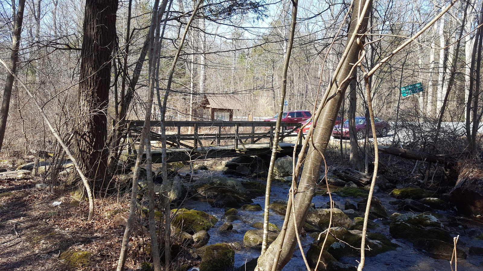
| Footbridge over Red Run, parking lot on PA SR 16 |
The trail crosses another 'water feature': Red Run, just before the parking lot and turn around point. There's a picnic table for you to sit, relax, and have a snack before turning around. The AT picks up straight across the highway, heading into Pennsylvania's
Michaux State Forest.
 |
| This section of trail maintained by the Waynesboro (PA) Potomac Appalachian Trail Club |
 |
| Red Run |
 |
| Veins of quartzite |
This was a moderately easy hike, maybe a shade over 4 miles round trip. There are enough steep ascents and descents to make it interesting, but altogether it was fairly straightforward.
As always, I recommend the use of trekking poles and solid boots. The trail is quite rocky, like the rest of PA.
Part Two coming soon.


No comments:
Post a Comment
Hello! Please leave your comments!
(All comments will be moderated, so if yours doesn't show up right away, please be patient.)