Lake in the mountains: Greenbrier State Park

Greenbrier State Park (GSP) is located not far from the Appalachian Trailhead on US40, the starting point of my previous hike to Annapolis Rock. Simply continue past the parking lot, cross the bridge over I-70, and the park entrance is about a half mile on the left.
GSP is a nice state park that offers numerous camping sites, fishing, boat rentals, several miles of hiking and mountain biking trails, and a beach for swimming during the warm summer months. For this outing, I chose the 4.5-mile "Big Red Trail" circuit hike.
A couple of notes about the trail:
- Difficulty: Moderate to Strenuous, depending on your fitness level. Much of the hike is fairly level or gradual ascent/descent. There are a couple sections of steep climbs, and a steep descent toward the end. The composition of the trail adds a bit to the difficulty, and I felt it could have been a little better maintained in spots. Both the steep climb and descent had plenty of loose rocks. Wear boots with good ankle support and bring a walking stick.
- Solitude: Obviously during the summer months, the beach is going to be a popular destination, as it was on the Friday I was there. The trails, however, seemed almost totally deserted. I came across one mountain biker while hiking, and a small group of kids later in the hike coming from one of the side trails from the campground.
- Other: There is a fee to enter the park.
Memorial Day weekend-Labor Day weekend, weekends and holidays $5/person; Memorial Day weekend-Labor Day weekend, weekdays $3/person; May and September, weekends $3/person; Labor Day-Memorial Day $3/vehicle. Out-of-state residents add $2 to all day use service charges.
Warning:There is a section of this park that becomes a hunting area during hunting season(s). I believe these areas are marked with signs. If you hike at Greenbrier SP during hunting season, please make sure you wear blaze orange.

I started my hike from the northern side of the lake, walking across the earthen dam to get to the trailhead.


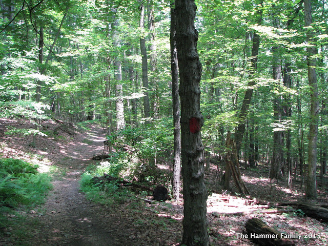
The trails are marked well, and there are signs at pretty much every intersection. Obviously, follow the red blazes and you can't go wrong.
The Big Red Trail starts with a gentle climb along the side of the hill.
Near the top, you'll come across the "Copperhead" side trail.

Note: some of the display maps show a "short cut" around the Red Trail dog leg section. This section was closed for rehabilitation, so you'll be taking the long way. Enjoy it!
The trail winds down the back side of the hill, until you come to a T intersection with the Blue Trail. Take a right here.


There's another left turn ahead. According to the maps, going straight would lead you out of the park to a road. After turning the forest becomes a little more dense and close.


Eventually, you'll come across a small stream, outflow from Greenbrier Lake. The stream was too wide to jump across, so I just trudged on through.

The steepest climb on the Big Red Trail comes after the intersection with the grey-blazed fire trail.

The rest of the Big Red trail is fairly easy, continuing along the ridge line.


However, the descent down from the ridge back to the lake is steep and rocky, so take your time.

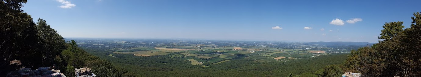
Once you reach the bottom, you're treated to a nice view of the lake and the ridge of South Mountain.

You can also see Annapolis Rock from the side of the lake.

