

I've been planning to get back on the AT for some time now, but sometimes life unfortunately gets in the way of living.
I was initially going to do this hike from Washington Monument State Park, but felt I should probably try it first from the AT Trailhead on US40, where the AT crosses over Interstate 70.
After a bit of an argument with my google maps navigation, I was able to finally reach the trailhead parking lot. If you're coming from eastern Maryland, take I-70 to exit 42 to get onto Highway 17 (Myersville), and follow your google maps navigation to get to US40.

Notes
Trailhead
From the parking lot, a section of old road leads you to the trailhead. It's well marked and hard to miss.

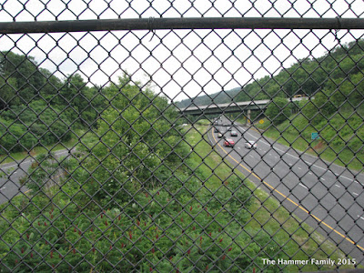
Since it was there, and since every time we drive to Iowa, we pass under it, I decided to cross the foot bridge (and back again) over Interstate 70.
looking back toward the footbridge


Continuing in this direction leads you to the aforementioned Washington Monument State Park and the first completed monument to our nation's first president.

Back to the north bound side of the trail, which passes beneath US40 and turns up the mountain.


After you pass through a power line cut, you'll hit the first side trail to the Pine Knob Shelter. Side trails from the AT are blazed in blue.

You'll bear right here and continue up the mountain. The trail will become significantly steeper and quite rocky. Take your time to navigate the rocks- this is where a hiking stick or trekking poles come in really handy.
Note: I unfortunately didn't snap any pictures of the steepest sections, so you'll have to take my word for it.
Once you reach the top of the ridge, the trail becomes much flatter, and...FERNS!

The trail is fairly flat here - a nice reprieve from all that climbing you just did. There were some spots that got really muddy from all the rain we've been having, but there were paths beaten around the worst parts. This is your reminder to have a second pair of shoes and socks waiting for you in the car.
At about the 2 mile mark, you'll reach the side trail to Annapolis Rock. To reach the vista, you'll descend about two-tenths of a mile.


There are also camping sites at the Annapolis Rock area, as well as a site for the caretaker/ranger. These PATC trail patrol "ridgerunners" provide support to hikers, educate the public on the "leave no trace" and minimal impact hiking ethos, and conduct light trail maintenance, among other duties.
Although I didn't hike to it, there is a spring in the Annapolis Rock camping area. If you're just doing a day hike, you should bring plenty of water with you. Do not drink from the spring without using some sort of water purification first. Even spring water could be contaminated.
Ok, enough with the talk: here's what you hiked over 2 miles to see:
Looking south toward Greenbriar Lake State Park

Looking west


If you want to add some mileage to your hike, you can head for Black Rock Cliff. Once you return to the AT, head left (northbound) at the intersection. Another mile down the trail, there will be a side trail for Black Rock Cliff. Apparently this isn't very well marked, but you should come across the side trail before the trail descends sharply.
Final thoughts and recommendations
If you're looking for solitude (and a parking spot), I recommend you try this hike on a weekday. This is a popular hike, so during the spring/summer weekends, there will probably be a fair number of people on the trail. Parking at the lot on US40 is limited, so arrive early.This would be a great hike in the fall, when the leaves are changing colors, and if I can manage, I'll hike it again at that time.

Happy Hiking!